Modulo

Google Earth

No reviews
Recommended Ages
Google Earth can be used from late elementary through high school and beyond. Younger kids may focus on simple "find and explore" activities, while older students can engage in more sophisticated mapping and analysis.

2nd-12th Grades

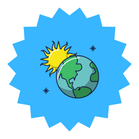
Google Earth is a free, interactive globe that lets students zoom from space down to city streets, visit landmarks, and trace journeys around the world. For homeschoolers, it can turn geography, history, and earth science lessons into vivid, place-based experiences: you can "fly" to a country you're studying, follow the path of a historical event, or examine landforms up close. Features like Street View, 3D buildings, and guided Voyager stories add layers of context, while measuring tools and overlays can support more advanced mapping projects. Google Earth is not a curriculum on its own, but it can dramatically deepen many lessons when used intentionally.

Google Earth is ideal for curious learners who love maps, travel, and visual information. It works especially well for kids who benefit from seeing concrete examples of abstract ideas like landforms, climate zones, or the scale of historical journeys.

Pros

Free, powerful, and visually compelling; brings geography and history to life; and supports a wide range of open-ended projects.

Cons

Cons: Requires capable devices and good internet; can be overwhelming without structure; and does not provide a built-in curriculum or assessment.

Google Earth itself is free and not something families typically purchase with ESA, charter, or other funding. However, the devices and internet access required to use it may be supported by some programs.

Google Earth is free to use on supported devices and browsers.

Google Earth
$0.00 USD

Skills

What kids will learn

Google Earth Mission

Google Earth's broader goal is to help people explore, understand, and care about the world by making it possible to virtually visit almost any place on the planet.

Google Earth Story

What began as a standalone application has evolved into a web-based experience and a suite of tools that integrate with Google Maps and other services. Along the way, Google Earth has added features like historical imagery, environmental layers, and storytelling tools that allow educators and organizations to create guided tours and narratives.

About Modular Learning

FAQ: Additional Details about Google Earth

In a typical Google Earth session, students search for a place, zoom in and out, toggle between globe, map, and Street View, and sometimes follow guided tours. The experience feels like a blend of atlas, field trip, and interactive storybook.

To use Google Earth, open the app or website, search for a location, and use navigation controls to zoom, tilt, and explore. Additional layers, Voyager stories, and measurement tools can be turned on as needed.

Adult involvement is especially helpful in framing questions, pointing out features, and connecting what students see in Google Earth to broader topics in geography, history, or science.

Students need a device that can run Google Earth (browser or app), basic navigation skills with mouse or touch, and enough reading ability to search for locations and read labels. Adults should be comfortable designing or adapting simple activities around the tool.

Google Earth does not have built-in lessons or adaptive pathways, but families can personalize it by designing their own tours, pinning locations that matter to them, and combining it with readings, documentaries, or projects. Learners can follow their curiosity to explore places they care about while adults guide how that exploration connects to academic goals.

Google Earth can both support and challenge learners with ADHD: it offers a highly engaging visual experience, but also many possible distractions. Using it for short, targeted tasks rather than open-ended wandering can help maintain focus.

For some autistic learners, the structured visual environment in Google Earth can be soothing and absorbing; for others, navigation and 3D graphics may be disorienting. Clear goals and limits, plus time to practice controls, can make sessions more successful.

Google Earth does not teach math directly, but can support spatial reasoning and basic concepts like scale and distance. Pairing its measurement tools with explicit instruction can make these ideas more concrete.

Google Earth relies heavily on visual information rather than long text passages, so many learners with dyslexia may find it accessible. However, reading place names and labels can still pose challenges, so read-aloud support may be helpful.

Google Earth includes smooth zooming and rotating animations that some kids enjoy and others may find dizzying. Adjusting navigation speed, limiting quick spins, and taking breaks can help learners with sensory sensitivities.

Google Earth is a flexible exploration tool rather than a therapy program. It can, however, be incorporated into social studies or science projects for many learners with diverse support needs, especially when adults provide structure and scaffolding.

Gifted learners often enjoy using Google Earth to follow their curiosity-diving deeply into particular regions, historical sites, or environmental questions. It can support independent projects and research when paired with readings and primary sources.

For twice-exceptional learners, Google Earth offers a rich environment for independent inquiry projects while still allowing adults to layer in accommodations and support as needed.

Profoundly gifted students may use Google Earth as part of advanced geography, history, or environmental science projects, including mapping research findings or analyzing satellite imagery over time.

Google Earth can both support and challenge learners with ADHD: it offers a highly engaging visual experience, but also many possible distractions. Using it for short, targeted tasks rather than open-ended wandering can help maintain focus.

For some autistic learners, the structured visual environment in Google Earth can be soothing and absorbing; for others, navigation and 3D graphics may be disorienting. Clear goals and limits, plus time to practice controls, can make sessions more successful.

Google Earth does not teach math directly, but can support spatial reasoning and basic concepts like scale and distance. Pairing its measurement tools with explicit instruction can make these ideas more concrete.

Google Earth relies heavily on visual information rather than long text passages, so many learners with dyslexia may find it accessible. However, reading place names and labels can still pose challenges, so read-aloud support may be helpful.

Because interaction in Google Earth is mostly point-and-click, learners with dysgraphia can participate fully without extensive writing. Any written outputs can be handled through typing, voice typing, or alternative formats.

Google Earth is free to use and does not require a subscription, so there is no refund policy to manage.

Google Earth may be less of a fit for families who prefer entirely offline learning or who do not have reliable internet or devices that can handle 3D graphics. It can also be overwhelming without adult guidance, as there is no built-in structure or progression.

Families may also explore tools like Google Maps, National Geographic resources, traditional atlases, and globes. For more structured geography curricula, dedicated programs and workbooks can complement Google Earth explorations.

Google Earth is updated regularly with new imagery, improved features, and occasional new storytelling tools, so the experience and data continue to evolve over time.

Tie Google Earth sessions to specific questions: for example, "Can we find three different types of landforms near this river?" or "What does the neighborhood around this historical site look like today?" This keeps exploration focused and meaningful.

Contact form

Meet Google Earth

Google Earth was created by a team at Google that built on earlier digital mapping efforts to create an interactive, 3D representation of the planet. Over the years, cartographers, engineers, designers, and educators have all contributed to making Earth a powerful tool for exploration and learning. A fun fact: early versions of the technology behind Google Earth were originally developed under the name Keyhole before being acquired by Google.