

The Decolonial Atlas
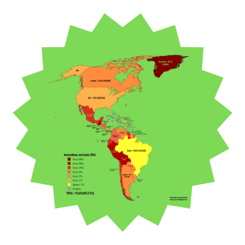
The Decolonial Atlas is an online mapping project that presents decolonial and Indigenous-centered maps of the world, highlighting traditional place names, language regions, and alternative ways of seeing borders. Created by activists and cartographers, the maps challenge Eurocentric views and invite learners to consider how power, history, and naming shape geography. Teachers and families use the site to supplement history and social studies with visuals that foreground Indigenous perspectives. Because the project is freely accessible, it’s a powerful tool for rethinking map literacy and global awareness.
Skills
What kids will learn


Need Help?
Try our AI learning concierge
Our AI learning concierge can give you custom recommendations for curriculum, tutors and classes based on your child's unique learning needs.
==>>Ask AI
Explore resources
Visit our collection of curriculum, tutors, classes and clubs. Filter by subject, grade, style, days and times to find exactly what you need for your unique child.
==>> Explore Resources